The Ovens Mouth is a spectacular, narrow passage that can be safely transited, paying attention to the strong current. The Cross River runs in a northeasterly direction from the Sheepscot River, north of Barters Island, through the Ovens Mouth. Once through the Ovens Mouth passage, the river opens up into a large tidal basin. Additional excitement is provided by the seals, eagles, and osprey that fish in the swirling currents at the east and west ends of the Ovens Mouth. The calm waters in the basin provide a peaceful anchorage away from fog and tourists and a body of water conducive to paddle boarding, kayaking, or dinghy sailing.
Ovens Mouth
Approach & Cautions
Photo: Zdenka Griswold
Leaving the Cross River bell RG “CP” to port, enter the Cross River paying close attention to the rocky shoal at the very northern tip of Barters Island. Navigating the Cross River is straightforward using GPS, though caution is advised. As you transit toward High Head, beware of the mudflats extending from the north into the channel. Dodging lobster pots is challenging in this stretch of water! The entrance to the Ovens Mouth is difficult to see until you pass “High Head” to port. Once past High Head, you’ll notice a half-dozen mooring balls to port. Leave the moorings to port and head down the middle of the Ovens Mouth passage, being careful to avoid the small ledge to port as you enter. Passage through the Ovens Mouth is best attempted at slack tide or one hour on either side of the ebb or flood, with the latter preferred to have better steerage as you transit. Currents can run greater than 4 knots at certain times.


Docking, Anchorages, or Moorings
The large open basin to the east of the Ovens Mouth is best for anchoring. The water going south is quite shallow at low tide but worth a trip in a small outboard. The basin extends 2 miles south of the Ovens Mouth. The moorings outside the Ovens Mouth are privately owned.
Getting Ashore
Photo: Zdenka Griswold
There are lovely hiking trails (described below) along the south side of the passage in the Ovens Mouth Preserve, a network of trails owned and maintained by the Boothbay Region Land Trust (BRLT). See a map of the area below and this link for their trail maps. A Guide user offers this information: “Ovens Mouth is a great stop heading up to Wiscasset or leaving to go down river, continuing your cruise. Wiscasset’s Waterfront has increased the number of available moorings ($30/ night on town mooring, donation at Wiscasset Yacht Club). Pump Out Station will be running this summer and dock space is available ($3/ft). Three restaurants and downtown merchants are a short 1/8th of a mile walk down Water St where you will also find Red’s, home of The Best of Maine Lobster Roll!”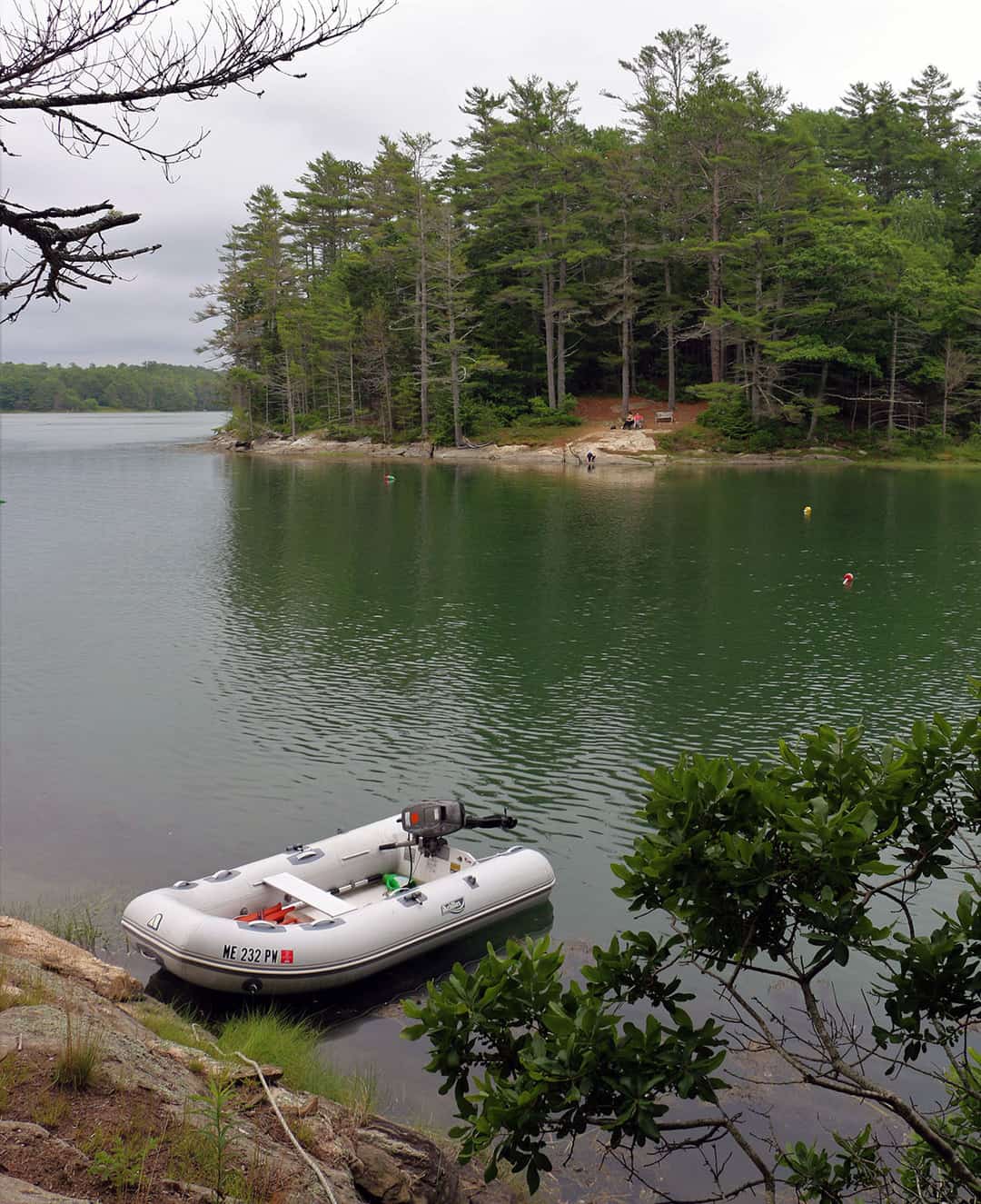 You can land your dinghy in either cove and tie your painter to a rock or tree.

This map shows all preserves managed by Boothbay Region Land Trust. Ovens Mouth Preserve comprises two distinct peninsulas connected by a pedestrian bridge. This preserve features BRLT’s most extensive trail system with over 5 miles of hiking trails. Both the East and West sections of Ovens Mouth are heavily wooded and feature partial water frontage and shoreline trails, quiet coves, and salt marsh, as well as stunning areas for picnicking, nature studies, and watching the dramatic tidal change of the Ovens Mouth passage. Both peninsulas are home to various wildlife, including eagles, osprey, otters, and deer. The East and West sections of Ovens Mouth Preserve are connected by a 93-foot pedestrian bridge which provides excellent views of the waterways as well as the opportunity for more extensive hiking across the trail system. Ovens Mouth East is a wooded, hilly property on 60 acres. Its easy trails include a 1.1-mile loop trail through woods with plenty of scenic water views along the Back River, as well as a shorter .5-mile wooded trail ending in a scenic view of the Back River. Ovens Mouth West, on 86 acres, provides more challenging hiking on 3.6 miles of trail. The longest stretch of trail on the west side is a 1.75-mile loop trail through woods and along the shore. There are a number of intersecting shorter trails as well that provide a variety of hiking options on this extensive preserve. 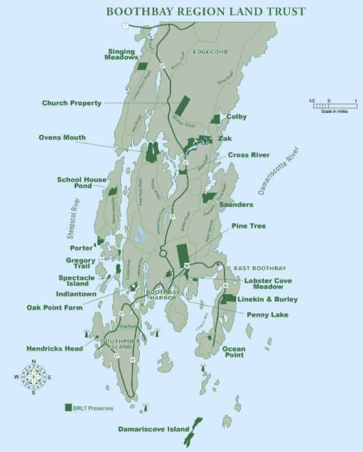
OUR REVIEWS
What CCA Members are saying:
