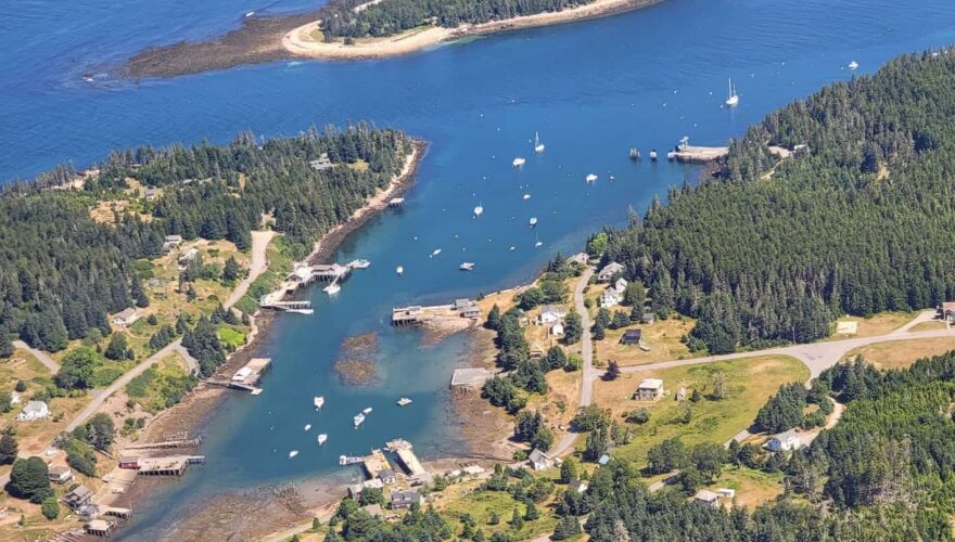
The small, tenacious community of Frenchboro is a long standing and constantly evolving tribute to the working people who settled and call home the remote outer perimeter of the three thousand islands along the Maine coastline. From cockpit level your eyes appreciate the small prim well-cared-for houses of the village that line the road. The paved single-lane runs around the head of the high-sided, pie-slice of a harbor. The incredible screensaver setting, with a placid pool of tranquil water stretching inland, lapping against industrious and beefy wooden docks of the working lobster fleet all the way to the tidal marshes beyond, begs poetry. But, what you ogle over at high-tide is, in a handful of hours, replaced by the fang toothed wreckage left behind by those generations of brave watermen and their families working a tenuous trade on the very edge of the world’s economy. The flats are a burial ground for broken wooden docks, rusting metal blocks, abandoned tackle, and braided wire. Granite blocks with broken sunken planks made from green timber and iron bolts sit in the mud. The last abandoned pilings still standing are battling each double-digit tide. It is a beautiful tribute to tenacity.
Frenchboro (Long Island)
Last edited by:
- Bob Rubadeau
- June 24, 2023
- 6:58 am
- 0 comments
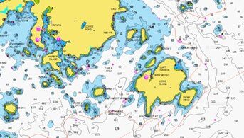
Region:
Photo: Mary Rubadeau
Approach & Cautions
Photo: Dale Bruce
Long Island is a lovely heaping mound of green trees, granite ledged shoreline, and is easily approached from all directions with navigational issues well marked. After spending a single evening inside the tight protective confines of Lunt Harbor you will better understand the strong tidal forces swirling around your track to fetch this welcomed refuge. The harbor shoals quickly and local knowledge plus a rising tide is necessary to go much past the first permanent docks to starboard.
Docking, Anchorages, or Moorings
A large ferry dock to port on entering the outer harbor opposite Harbor Island connects visitors, local high school students and residents with Bass Harbor on Mt. Desert. There are mooring balls just outside and just past the working pier but no public landing or dinghy access to shore is close at hand. This is a fishing and lobstering harbor and the workboats are lined up along two-thirds of the port-side inner harbor. A single waving line of a dozen or so oddly mismatched mooring balls are to starboard where you might find an empty ball and tether your line for the night. These odd ducklings are often open. In the past, Lunt and Lunt, who own the floating dock and the small restaurant, would be glad to rent these moorings to transients; we’re checking on that for 2023. The Dockside Deli will be open July 4 to Labor Day. It seems that it is customary to pick up an empty mooring, make yourself at home, and wait for guidance. Anchoring in good mud beyond the moorings under the shadow of Harbor Island is often acceptable in settled weather. Always be mindful of the strong current swirling into the anchorage around Harbor Island, which often displays an unnatural tidal chop and small whirlpools during tidal changes. It is advised to stand ready to relocate further inside the harbor if conditions warrant. For a different and very unique experience, you might want to try Eastern Cove on the southeastern side of Long Island. Generally a settled anchorage except when the wind is in the north or northeast, you’ll likely find an incredible dual berm on the isthmus that connects Richs Head and Long Island. The berm to the southwest is composed of year’s worth of driftwood while the berm to the northeast is made of perfect rounded stones. The only caution is that because of the rocky bottom you may find anchoring a bit challenging.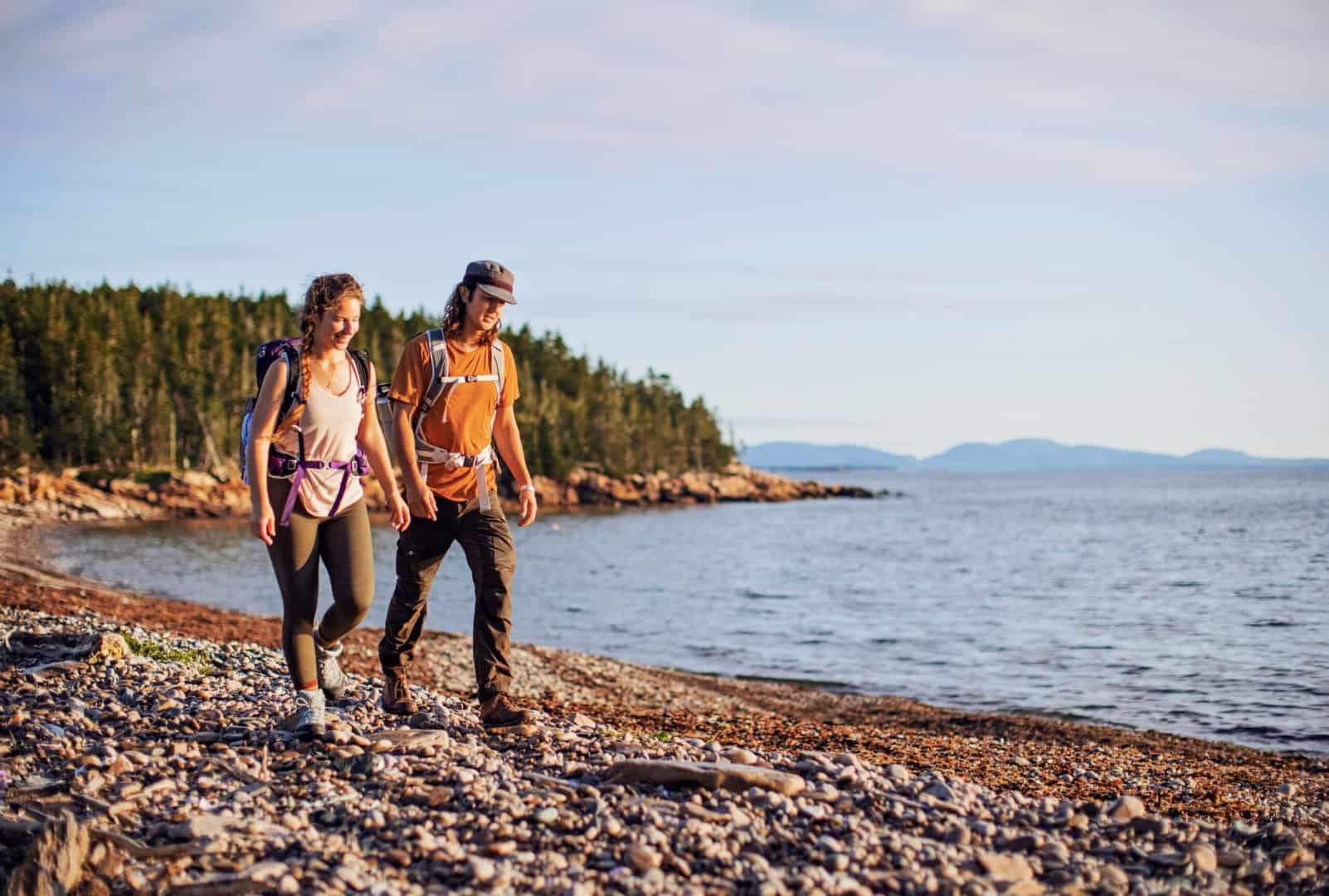
Getting Ashore
Photo: courtesy of Maine Coast Heritage Trust
The Lunt and Lunt dock is still the best place to land a dinghy if room is available. Farther inside to port is the town’s working dock. No one seems to mind leaving a dinghy tied here while you take a walk. One of the bucket-list scenic hiking opportunities along the entire Acadian seacoast makes Long Island and Frenchboro something special for a cruising boat. The Maine Coast Heritage Trust (MCHT) began its work in 1970 and now protects 170,000 acres and over 330 islands, which includes over 150 public preserves offering over 100 miles of hiking trails. In 1999 MCHT joined the Island Institute and the Maine Sea Coast Mission in the effort to protect the Frenchboro Preserve and keep wild 8.2 miles of shoreline and over 1100 acres of pine forest, wetlands, and rock-strewn beaches from development. David Rockefeller was instrumental in this effort and donated a large portion of the land that encompasses the preserve. The Trust was also able to add a second parcel to the island’s public lands and included Rich’s Head in 2011. The Maine Coast Heritage Trust website is a technical and visual delight with detailed maps and information on their special projects and campaigns to preserve access to the Maine coast. The trail map for the Frenchboro preserve is very helpful! While in Frenchboro visit the Historical Society building at the head of the harbor a short walk up the road to the east and opposite the small one-room schoolhouse. No other stores or supplies were available in 2022.

OUR REVIEWS
What CCA Members are saying:
The walks in the Frenchboro Preserve are some of the finest headland and tidal rock walks on the outer islands of Maine. A walking roundtrip can take better than an hour. Bring water.

Bob Rubadeau
