McGlathery

44° 7' 43"N , 68° 36' 44"W

Stonington

Last edited by:

Photo: Aerial photo by Doug Bruce with Frank Simon, pilot

McGlathery is a 140-acre conservation island in the southeastern quadrant of the stunning Merchant Row archipelago. This is a 12-square mile flock of hardbound islands filling the sea between Stonington and Isle Au Haut. Several years ago, I circled Merchant Row on the chart and asked my 8-year-old granddaughter to count the number of named islands inside the circle. She came up with 40. I'll take the risk of saying that the waters of Merchant Row offer the most beautiful and varied sailing on the coast of Maine and, therefore, the coast of New England. McGlathery is an easy and convenient place to spend one or more nights enjoying this spectacular area.

McGlathery was one of the first Maine islands put into conservation by private philanthropy. Since 1954, it has been owned by a Canadian conservation organization called Friends of Nature. In 2021 ownership was transferred to Maine Coast Heritage Trust. The story of the McGlathery conservation success is noteworthy and has become a model for private conservation projects in Maine ever since.

Approach & Cautions

Photo: Rocks at landing beach by Mark Gabrielson

A cruiser may enter Merchant Row from either the east or west. Although GPS and chartplotters have largely eliminated spatial disorientation on boats, your crew might initially be bewildered by the sheer number of islands and passages in all directions. They should relax; the water is deep, and the hazards are well-marked.

From the east, a safe approach to McGlathery is to leave Southern Mark Island (a distinct barren island) and Colby Ledge (red daymark) to port. Also, leave No Mans Island to port, then steer about 270o M into the cove on the northern shore.

Sandy beach studded with boulders, calm water and wooded island beyond.

From the west, the easiest route is to pass south of Mark Island with its quaint lighthouse (preserved by the local Island Heritage Trust) and make for the red nun 4 just north of Saint Helena Island. Turn through the passage that opens up between Bare and Coombs and proceed towards McGlathery.

Click the chart to open Navionics.

Not to be used for Navigation.

Docking, Anchorages, or Moorings

There’s a cove on the northeast side of McGlathery (the cove’s east side is extended by Little McGlathery). Drop the anchor in 10 feet of water at low (20 feet at high given tidal range). You’ll be well protected from the prevailing sou’westerlies. The bottom is mud, and the current insignificant. Either the northwest or southeast ends of the cove can accommodate a substantial yacht.

Note that the charted rock denoted by the in the center of the cove is precisely where NOAA says it is.

The anchorage only can handle two or three boats. Four feels crowded. If you have neighbors or the wind is northerly, a fallback option is to circle north of McGlathery, and anchor to the west of McGlathery and east of Round. Approach only from the north if you do this. Be mindful of the shoals running between McGlathery and Round. This anchorage also has a significant tidal current so use plenty of scope.

Getting Ashore

Photo: Landing Beach at NE cove of McGlathery by Dale Bruce

Once secure on the anchor, you have three options. The first is a quiet cockpit lollygag. Watch the sunset through the trees, the gulls and shags settling down for the evening, the distant lights of Stonington sparkling across the water, and if you’re quiet and lucky, a harbor seal cruising past to see if you’ll toss a snack. The second is to take a small boat ashore. Use the sandy pocket beach that fills the southeastern crook of the main cove for an easy landing. Explore the beach and interesting reddish sedimentary rock making out from the forest edge. Or third, strike off into the wild interior of McGlathery. It’s a deep forest walk along largely unmaintained paths, and trails kept open by visitors and deer. It’s Maine island wooded wilds at its best. Bring good shoes and bug repellant or a bug shirt with a hood, and do a tick check later.

McGlathery is close to many other Merchant Row islands worth exploring, many of which are Maine Coast Heritage Trust preserves. If you have a capable dinghy or have shipped a kayak or two, you should plan on spending a few days exploring this wonderful area in your small boat—for example, paddle or putter 1.75 NM to the northwest to Green Island. Tie up to the granite wharf inside the notch on the south side of Green, climb the short ladder, and follow the well-worn path to the small, clear and warm freshwater quarry pool for a swim. It’s heaven on a warm day.

Sandy beach showing ledge and boulders, with tall firs behind.

Lobsters, Fishers, Boats, and TrapsLobster boat with trap on the gunnel.

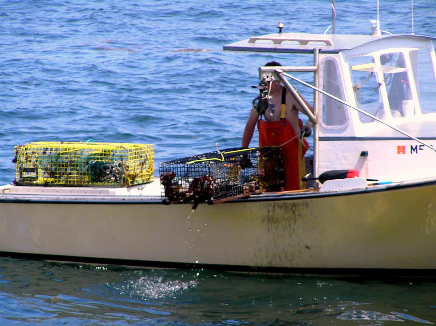
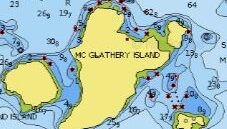
McGlathery, and Merchant Row, sit south of Stonington, home to Maine’s largest and most successful lobstering fleet. Between 0430 and 0600, over 100 lobster boats fire up Mondays through Saturdays, collectively powered by about 30,000 horsepower of diesel engines. Then between 1030 and 1330, they barrel back to one of four Stonington co-ops to sell their hauls and refuel. By 1500 most are home with their families or working on their moored boats. They don’t fish on Sundays.

Our experience is that lobstermen are among the finest people on Earth. They are the first to help if you need it, are completely OK with sharing waters with sailors and kayakers, and sincerely appreciate how much we enjoy the fruits of their labors served at home or in the local restaurants.

Lobstermen (and women) are working while we cruisers are vacationing. And they’re working hard. What they legitimately worry about is cruisers fouling their trap rigs. When we sail in Merchant Row, we reduce the risk of a warp foul by shunning the engine and sailing as much as possible, passing pots to the up-current side, and giving any workboat actively hauling a wide berth. We think hard about where we drop the hook when lobster traps are in the area.

We also always wave, and 9 times out of 10 get a hearty wave in return.

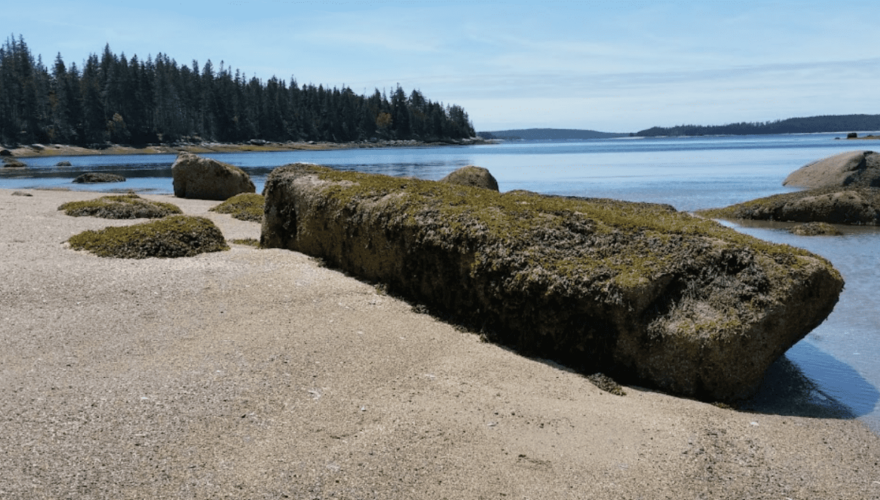
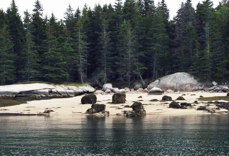
It’s important to know that the McGlathery anchorage is near, but not too close to, the primary lobster boat thoroughfares into and out of Stonington. If you happen to be awake early in the morning, you’ll hear the fleet heading out at first light; but it will be a distant rumble. Furthermore, lobster boat wakes that can make anchorages rolly don’t seem to affect McGlathery quite as much.

One final thought: FOG! When Maine is thick with fog, McGlathery and much of Merchant Row can (on occasion) be clear. Isle Au Haut lies upwind of this area during prevailing southwesterlies. It’s big enough to warm the damp air, and a lens of clear air can form in its lee to the north. But if this isn’t happening, and the islands are wrapped in fog, radar and a good radar reflector are essential. Inshore lobster boats DO NOT USE AIS. They do use radar. That said, be ever cautious. Lobstermen have incredible local knowledge and confidence in their piloting skills, so they aren’t always attentive to radar screens. They also can’t hear our fog horns over the 300+ HP diesel that they’re running at nearly full throttle as they sprint home to get the best dock pricing for their catch!

OUR REVIEWS

What CCA Members are saying:

Got some feedback or notes for this page?

Send us your input.

Subscribe to our newsletter for updates your inbox

Name