On the east side of Vinalhaven, this very secluded yet accessible and protected bay has gorgeous Maine scenery, many nooks and crannies to explore, and diverse wildlife, including seals and bald eagles. There are many hazards, but they are well charted. Find a spot to drop a hook in the inner harbor, then take the dinghy around the islands at high tide to explore the coastline. You can even go up into Winter Harbor near mid- to high-tide. Just remember to get back to your boat before the ebb catches you high and dry.
Seal Bay plus Winter Harbor
Last edited by:
- Doug Bruce
- April 11, 2025
- 12:32 pm
- 0 comments
Region:
Photo: Kate Wilson Somers
Approach & Cautions
Photo: Aerial of Seal Bay (center) and Winter Harbor (right) by Dale Bruce with Frank & Libby Simon, pilots
The entrance to Seal Bay plus Winter Harbor is located on the eastern side of Vinalhaven, just 1.5 to 2 miles south of the Fox Islands Thorofare. Start into Winter Harbor heading generally southwest. Watch out for the rocks to starboard in the outer entrance. Once inside, you can head a little farther toward Winter Harbor, and then turn left (south) into the gap between Little Hen and Penobscot Island. Then proceed cautiously in the deep water between Davids Island (to starboard) and Hay Island (to port), around the unnamed boulders to starboard into the first area where you can anchor. Or head into the inner harbor (past Burnt Island to port) where there is also a good thick mud bottom for anchoring. Moorings in this area are private and of unknown reliability. On the way in, make note of the rocks and shallow water along the Penobscot Island side of the channel. The rock is more of a hazard than the muddy shallows.

Docking, Anchorages, or Moorings
There are many places within Seal Bay and Winter Harbor where you can anchor. One of the “snuggest” and most secluded is all the way up in the inner harbor of Seal Bay, as far past Burnt Island as your keel will allow. The charted depths are remarkably accurate, but take care given the tidal range. One rock you’ll need to avoid is between the smaller Hay Island and the larger Penobscot Island. Favor the Hay Island side of the channel, go slowly, and you’ll be fine. Another popular spot for those who’ve been to Seal Bay a few times is the cove to the SE of Hen Island, just after turning the corner to enter Seal Bay. There is deep water (35 feet or more), and as long as the wind doesn’t pipe up out of the north, it will be very comfortable. Also, if you’re feeling brave (and careful), you can sneak out the narrow channel to the north. Other boats in the anchorage will wonder where you went. There are several anchorages going farther into Winter Harbor. One of the best is in the deepwater “hole” opposite Starboard Rock — but be careful to avoid the two-foot spot noted on the chart. Depending on your boat’s depth (and your adventurousness), you can anchor farther up this harbor, but the channel is littered with rocks and has shallow edges.
Getting Ashore
Photo: Courtesy of Maine Coast Heritage Trust
There are no amenities, but there are some excellent hiking paths around Seal Bay, thanks to the local land trusts listed below. It is usually a calm harbor — great for dinghy rowing, paddleboarding, and kayaking. And by August, the water may be warm enough for a quick swim. Other places of interest:

Seal Bay is another anchorage with beautiful light and many opportunities for memorable photography. This shot by Brian Ward was taken in August 2022. 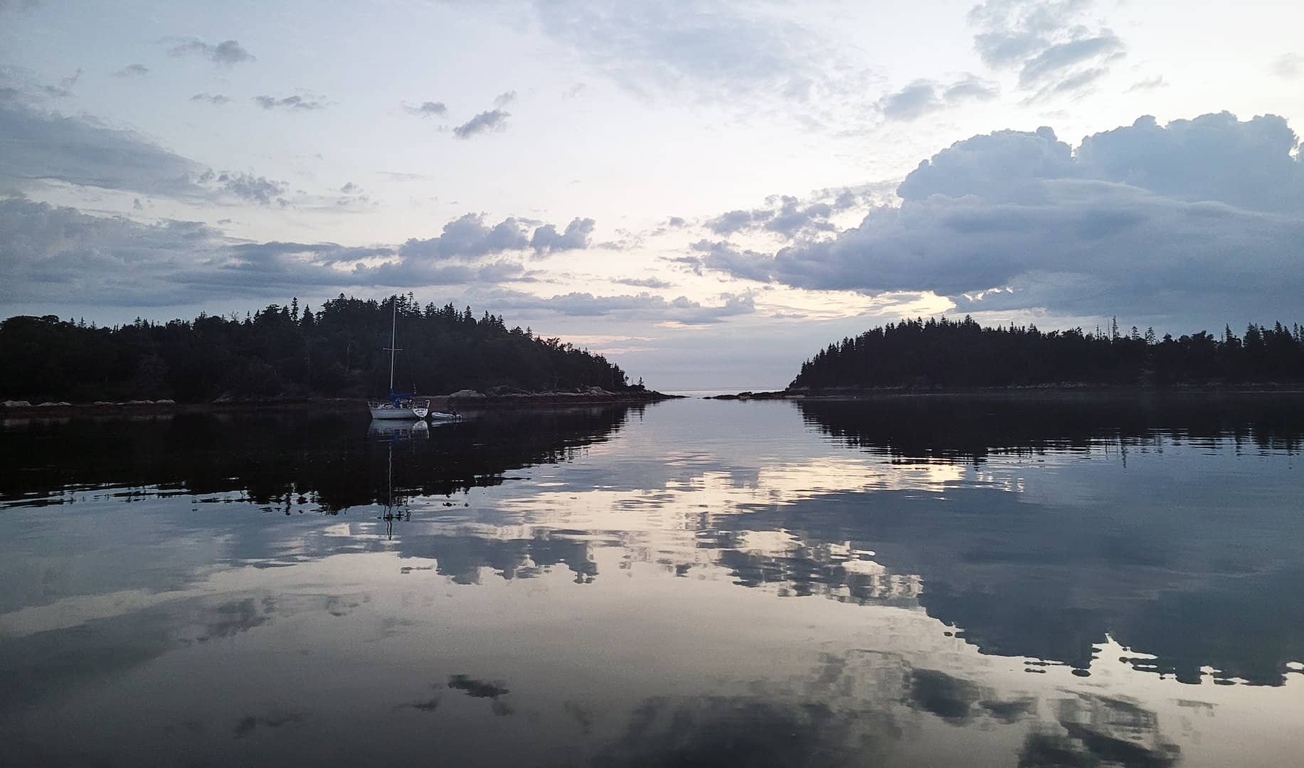
OUR REVIEWS
What CCA Members are saying:
This is our favorite “gunkhole” in Penobscot Bay. The scenery is always captivating, and the birdlife engaging. Best of all it's a place that lets you unwind, relax, and briefly forget your shoreside worries.
Doug & Dale Bruce
I walked the Huber Preserve and marked the trees on the shoreline near the trail with pink plastic ribbons. Oak Point is the best place to land (it should be on a chart). High tide (to half-tide) is still needed to avoid the dreaded mudflats if going by dinghy. The trail is beautiful and well-maintained. See the link above for a trail map.

Wendy Richards