Uninhabited Cross Island, along with Scotch, Outer Double Head Shot, Inner Double Head Shot, Mink, and Old Man Islands that surround it, is a National Wildlife Refuge (one of five Maine Coastal Islands National Wildlife Refuges) encompassing approximately 1700 acres. A few acres around the abandoned Coast Guard boathouse and house were given to the Hurricane Island Outward Bound School (HIOBS). It makes a great stop while Down East to go hiking and soak in the views or just relax in a place where you'll likely be the only boat. The HIOBS community has done some work on the buildings with new roof shingles and the plan is to do more this summer (2026)
Cross Island
Last edited by:
- Jen Haddock
- May 14, 2026
- 2:11 pm
- 0 comments
Region:
Photo: John R. Cobb
Approach & Cautions
Photo: John R. Cobb
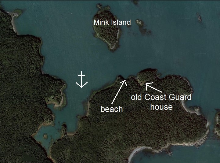
The recommended approach to the anchorage is from the southwest entering Machias Bay at Libby Island. Work your way around the west side of Cross Island. Be mindful of the salmon pens marked on the charts and note that each year there seem to be more, so give them some room, especially in limited visibility. Also, there can be boat traffic between the pens and Bucks Harbor. If you haven’t noticed them yet, as you work your way around the island, you will have a full view of the U.S. Navy’s low-frequency radio towers west of Cutler Harbor. Leave green can “7” to starboard. Be careful that the current isn’t pulling you closer to the obstructions to your east. As you round the can, head towards the north end of Mink Island. This will keep you off the obstructions to your right, which may not be visible due to the tide. Can “5” is part of the Cross Island Narrows, so should be left well to port. Once you are partway down Mink Island and have a clear view of the Coast Guard House, you should be clear to enter the anchorage area. The Cross Island Narrows on the north side of Mink and Cross Islands can be utilized as an anchorage, but there can be very strong currents running there, so plan accordingly. It is called “Narrows” for a reason. There are many rocks on the south side of the channel. If there is any swell running, this entrance can be very sporty with not much margin for error. With all that said, it is beautiful under the right conditions.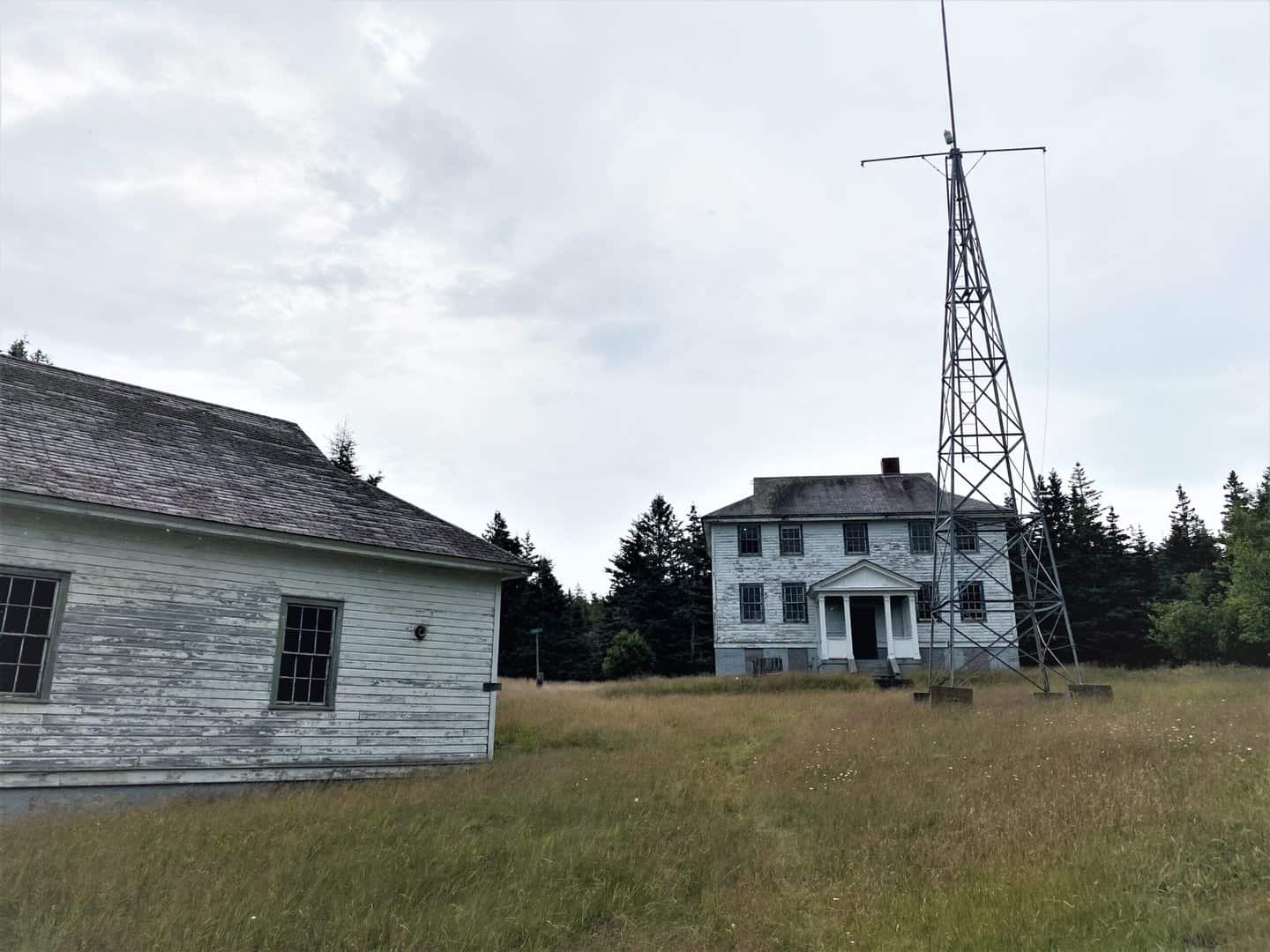

Docking, Anchorages, or Moorings
Beware of the obstructions to your starboard, staying close to the Mink Island side. You will be heading straight for the Coast Guard house. If the flags are up, then Outward Bound is in residence. Once you have the Coast Guard house in full view, you can turn south into Northeast Harbor. Work your way towards the cove, staying a bit to the west of center. It is recommended to get as far in as you can (depending on your draft) out of the current that can “rage” in the cut between Mink and Cross, at times approaching and exceeding 4 knots. The bottom is sticky mud so your anchor should dig in just fine if firmly set. You may find some moorings in the area, which are reserved for the Outward Bound Pulling Boats. They are light seasonal moorings for small pulling boats, and are not for visiting yachts.
Getting Ashore
Photo: Jen Haddock
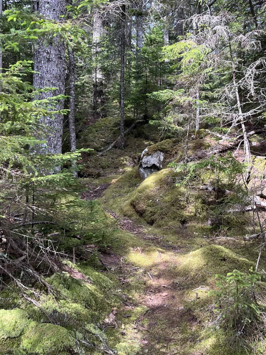
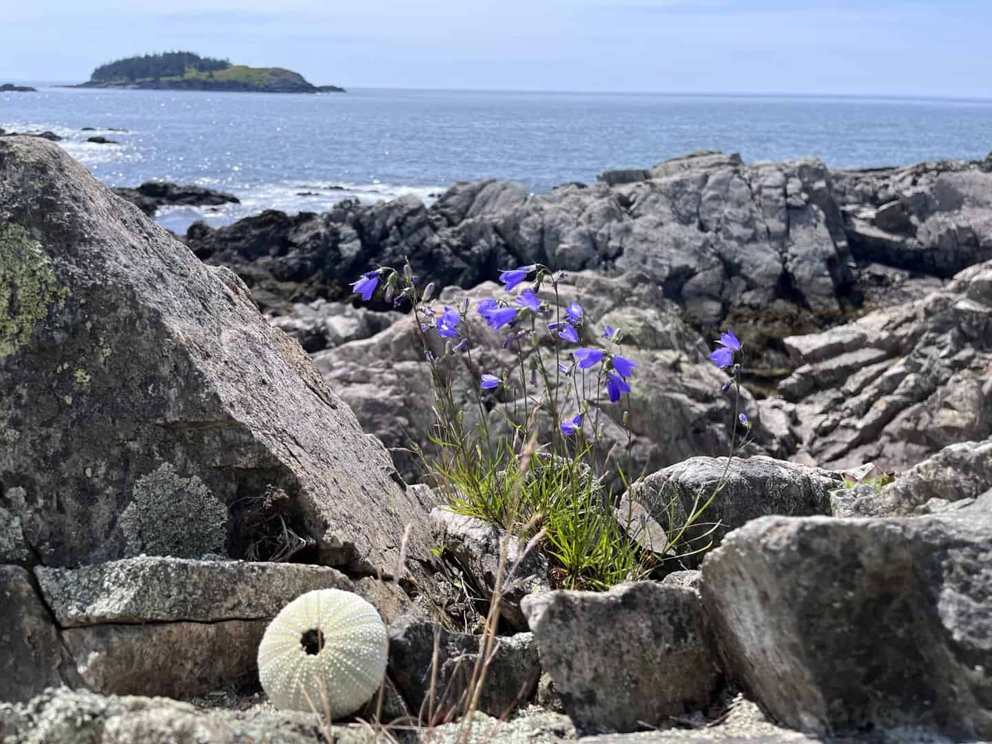
The landing spot labeled “beach” on the Google Earth image is the best place to land, but if you’re concerned about the current between Mink and Cross choose a landing spot on the east side of the anchorage. There are trails that you can find from there, and from the beach landing. If you head towards the house, you will find more trails. If the current is strong as you approach the beach from the anchorage, then stay close to the point. This is a great island for hiking. There are some maps in the Coast Guard house. The house is usually open, and if Outward Bounders are around, just introduce yourself and they can help you. It is recommended to take a picture of the map for your hikes. The hike out to the Surf Station is a nice short hike. The building has collapsed with age. A couple of longer hikes go out to Double Head Shot or out to the sea cave (be sure to check the tides for this one–you’ll want to depart the house 2 hours before low). The back side of the island is spectacular. You may even see a whale on a clear day!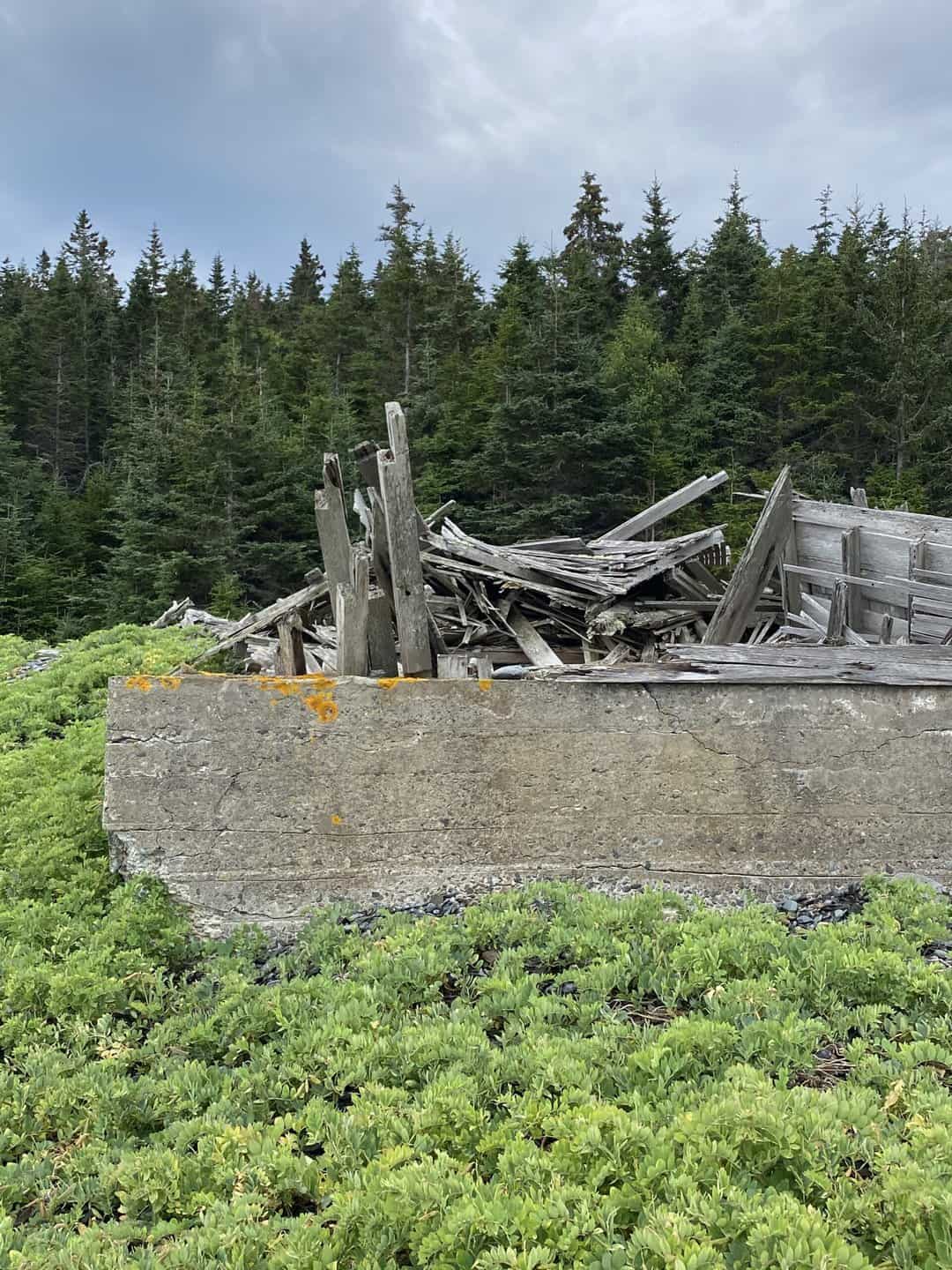

OUR REVIEWS
What CCA Members are saying:
Cross Island is a spectacular place. Great hiking trails. I have seen deer, eagles and even a whale on a clear day. Such an unusual place where you are in a remote setting while looking across the bay to the gigantic radio towers. Great holding ground..
Jen Haddock
