The Mud Hole is located in the center of the east side of Great Wass Island. It is an intimate, extremely well-protected anchorage with high, undeveloped shores and access to beautiful hiking trails. It exemplifies the quiet and scenic anchorage that many seek while cruising Downeast Maine.
Mud Hole
Last edited by:
- Sandy Andrews
- June 9, 2023
- 2:56 pm
- 0 comments
Region:
Photo: Doug Bruce
Approach & Cautions
Photo: Google Earth
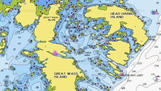
The Mud Hole is best approached from the south, leaving Channel Rock to port as you enter the Mud Hole Channel between Great Wass Island and the Mistake Island archipelago. The Mud Hole can also be approached from the north utilizing the channel between Head Harbor Island to the east and Sheep Island to the west, but this approach is convoluted, largely un-buoyed, and scattered with rocks and fish pens. There is also an approach directly from Moosabec Reach between Great Wass to the south and Pig Island to the north, but this channel is shallow; the chart claims a mid-channel depth of 4 ½ feet. Neither northern approach should be attempted without good visibility and/or a high degree of confidence in your electronic navigation systems and helmsman’s capabilities. When entering The Mud Hole itself, initially stay north of the ten-foot contour line along the southern shore of the entrance and head for the fourteen-foot spot marked on the chart. Once you arrive at this spot, alter course and hug the southern shore staying well away from the two reefs along the northern shore.
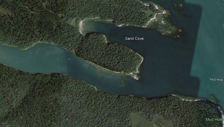
As marked on the chart, it is critical to note that there are only two feet of water in a large part of the entrance channel at low tide. Accordingly, the Mud Hole can only be entered or exited when the tide is sufficiently high. Once past the entrance shallows, the harbor deepens to ten to twenty feet, then shallows rapidly to the west. Be careful not to venture too far west. In recent years there has been a proliferation of mooring buoys (presumably aquaculture related) in the Mud Hole. For the most part, these are at the western end of the anchorage and mark the limit of deep water.
Docking, Anchorages, or Moorings
Anchor anywhere with sufficient depth (generally in the close vicinity of the 16-foot depth marker on the chart) while watching your fathometer carefully and keeping in mind the large tidal range. This is a tight anchorage that cannot accommodate more than five or six boats. Holding (heavy mud) and protection are excellent, so, in settled summer weather conditions, less scope than normal can be utilized to make room for more boats. As noted above, there are mooring buoys present at the western end of the anchorage. Using them is not recommended unless you have specific information about the tackle below the buoy.
Getting Ashore
Photo: Sarah Lorcheim
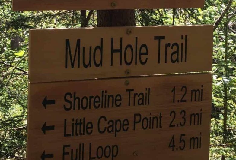
Most of the southern half of Great Wass Island is owned by the Nature Conservancy, which maintains a 4.5-mile hiking trail on the preserve. Information about this preserve and a trail map can be obtained from the Nature Conservancy’s website. This trail can be accessed from an anchorage by dinghy. If you row along the southern shore, you should see tree-tied lines hanging down the rocky bank to the water. Secure your dinghy to a line and clamber up the bank using the line as an assist. If you can’t find a line, climb the bank at a convenient spot and tie your painter to a tree. The bank is steep and high, especially at low tide, and very slippery, so much caution should be used–especially when descending. The trail parallels the shore and can be found a hundred or so feet up the hill from the shore. The trail itself is rough, particularly the southern section crossing the middle of the island, requiring proper footwear. All this effort is well worthwhile as the views and vegetation are lovely. The large, high rocks at Little Cape Point make for a spectacular picnic place.
OUR REVIEWS
What CCA Members are saying:
This is one of my favorite Downeast anchorages providing a serene environment, a peaceful night’s rest, and great hiking.
Sandy Andrews
